india nepal border
About 95 results (0.72 seconds)
 DigiNepal Placesdiginpl.com › places › indianepal border
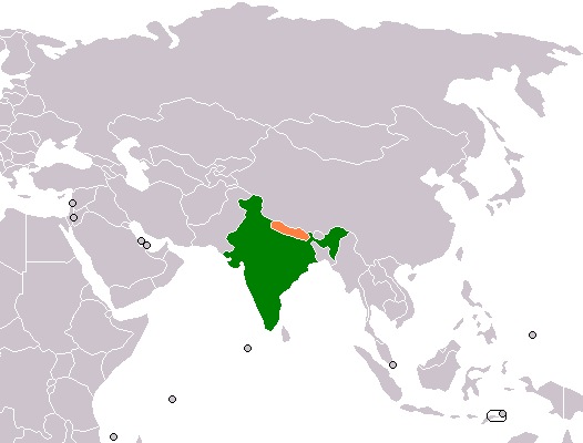
India–Nepal border
PlaceThe India–Nepal border is an open international boundary running between the countries of India and Nepal. The 1,751 km (1,088.02 mi) long border includes the Himalayan territories as well as Indo-Gangetic Plain of the subcontinent.…
 DigiNepal Placesdiginpl.com › places › nepal peak himalayas
Nepal Peak (Himalayas)
PlaceNepal Peak is a mountain in the Himalayas. It lies on the border between Nepal and India.
 DigiNepal Placesdiginpl.com › places › sharda river
Sharda River
Place…River (or Mahakali River) that originates in the northern Uttarakhand state of India in the Great Himalayas on the eastern slopes of Nanda Devi massif, at an elevation of 3,600 m (11,800 ft) in the Pithoragarh district. It then flows…
 DigiNepal Placesdiginpl.com › places › 2011 sikkim earthquake
2011 Sikkim earthquake
Place…of 6.9 and was centered within the Kanchenjunga Conservation Area, near the border of Nepal and the Indian state of Sikkim, at 18:10 IST on Sunday, 18 September. The earthquake was felt across northeastern India, Nepal, Bhutan, Bangladesh,…
 DigiNepal Placesdiginpl.com › places › gimmigela chuli
Gimmigela Chuli
Place…or The Twins, are two-peak mountains in the Himalayas, located on the border between Taplejung, Mechi, Nepal and Sikkim, India. गिम्मीगेला चुली नेपाल र भारतको सीमामा अवस्थित एक हिमाल हो ।
 DigiNepal Placesdiginpl.com › places › sandakphu
Sandakphu
Place…(11,929 ft) is a mountain peak in the Singalila Ridge on the border between India and Nepal. It is the highest point of the ridge and of the state of West Bengal, India. The peak is located at the edge of the Singalila National Park…
 DigiNepal Placesdiginpl.com › places › kangchenjunga
Kangchenjunga
Place…and in the east by the Teesta River. It lies in the border region between Koshi Province of Nepal and Sikkim state of India, with the West and Kangbachen peaks located in Nepal's Taplejung District and the Main, Central and South peaks…
 DigiNepal Placesdiginpl.com › kb › axz › places
Lalbakaiya river: transborder river flowing from Nepal to India
PlaceLalbakaiya river is a transborder river flowing from hills of Nepal to India. It crosses the border at Balua Gowabari. Its two major tributaries are Bakaya river and Dhansar river. Type: river. Sources: Wikipedia and Wikidata (Q113511383).…
DigiNepal Placesdiginpl.com › places › kankalini templeKankalini Temple
PlaceKankalini Temple is a temple and Shakta pithas in Eastern Nepal in Bhardaha VDC, Saptari, 19 km east of district headquarter Rajbiraj and near the Indian border at Birpur. It draws Nepali and Indian pilgrims, especially during Dashain…
 DigiNepal Placesdiginpl.com › kb › axz › places
Banganga River (वाणगंगा): transborder river flowing from Nepal to India
PlaceBanganga River is a trans-boundary river flowing from Arghakhanchi District of Nepal to Banganga, Kapilvastu in Nepal and mets at Ganges in Uttar Pradesh, India. It crosses the border at Jugdihawa. The river is of religious importance…
Related searches
Privacy: we keep only the text of searches, counted in aggregate, to improve results. No IP address, account or device is stored with it, and searches with personal details are not kept. Web results are fetched by our server, so providers never see who you are.