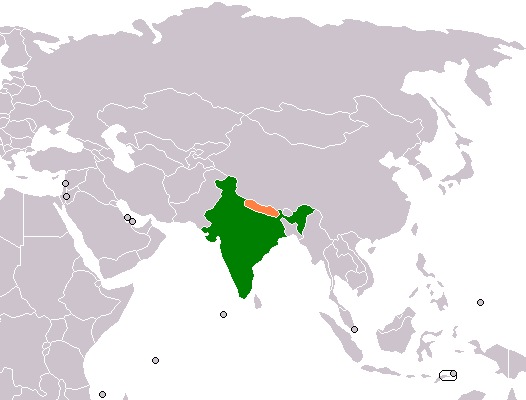
India–Nepal border
नेपाल भारत सीमा
Separates territories of India and Nepal
नेपालीमा पढ्नुहोस् · हिंदी में पढ़ें
- नेपाली · English · हिंदीRead in your language
- CitedEvery fact sourced
- Ad-freeNo ads, no tracking
The India–Nepal border is an open international boundary running between the countries of India and Nepal. The 1,751 km (1,088.02 mi) long border includes the Himalayan territories as well as Indo-Gangetic Plain of the subcontinent. The current border was delimited after the Sugauli treaty of 1816 between Nepal and the British Raj. Following Indian independence, the prevailing border was recognised as the international border between the Kingdom of Nepal and the Dominion of India.
Quick facts
- Type
- border, land boundary, international border wd
- Coordinates
- 30.2083° N, 81.5417° E wd
Nearby places
- China–Nepal border — 0 km
- Limi — 14 km
- Muchu — 18 km
- Namkha Rural Municipality — 18 km
- Khagalgaun — 20 km
- Dandaphaya — 33 km
Related
 Mount EverestEarth's highest mountain
 HimalayasMountain range in Asia
 KathmanduCapital and largest city in Nepal
 Kangchenjunga3rd-highest mountain on Earth
 Annapurna (mountain range)Mountain range in the Himalayas
 Dhaulagiri7th-highest mountain on Earth
 Makalu5th-highest mountain on Earth
 Lhotse4th-highest mountain on Earth
 Cho Oyu6th-highest mountain on Earth
 Manaslu8th-highest mountain on Earth
 PokharaMetropolitan city in Gandaki Province, Nepal
 LumbiniHistorical city in Lumbini Province, Nepal
Sources
- Wikipedia (English): India–Nepal border · CC BY-SA 4.0
- Wikipedia (Nepali): नेपाल भारत सीमा · CC BY-SA 4.0
- Wikidata item Q3088768 · CC0 1.0
- Image: India Nepal Locator.png by Aridd (Public domain)

Last updated · facts checked 7 November 2026
Cite this page
"India–Nepal border". DigiNepal. Last updated 2 October 2026. https://diginpl.com/places/indianepal-border. Retrieved 7 November 2026.