Himal Sagar
करिब 20 नतिजा (0.44 सेकेन्ड)
कसरी जोडिन्छ पेज खोल्नुहोस्
⤵ भएको बाकस थिचेर अझ हेर्नुहोस्।
सूचीमा
- Himal Sagar — प्रकार → व्यक्ति
- Himal Sagar — born → 1980-10-24
- Himal Sagar — birthplace → Jhapa District
- Himal Sagar — occupation → composer
- composer — · → singer
- composer — · → lyricist
- Himal Sagar — सम्बन्धित → यिनलाई पनि खोजियो · 2
- यिनलाई पनि खोजियो · 2 — · → Purnima Shrestha
- यिनलाई पनि खोजियो · 2 — · → Bharat Koirala
 DigiNepal Peoplediginpl.com › people › himal sagar
Himal Sagar
व्यक्तिHimal Gautam known widely as Himal Sagar is a Nepalese pop and modern singer, music composer and lyricist. He released his first original music album ‘Relation’ in September 2003. Of the 8 songs in the album, ‘Na Maile Lekhe, Na Unle…
 DigiNepal Placesdiginpl.com › places › sagarmatha zone
Sagarmatha Zone
ठाउँSagarmāthā Zone (Nepali: सगरमाथा अञ्चल, [sʌgʌrmatʰa ʌnt͡sʌl] "Sagarmāthā Anchal") was one of the fourteen zones of Nepal until the restructuring of zones into provinces. The headquarters of Sagarmatha is Rajbiraj. Sagarmāthā is a Nepali…
 DigiNepal Placesdiginpl.com › places › numbur
Numbur
ठाउँNumbur is a glaciated mountain located in the Rolwaling Himal mountain range of Nepal. The 6,958 metres (22,828 ft) high Numbur is located at 43 km southwest of Mount Everest, on the border of the Janakpur and Sagarmatha zones. One…

मानिसहरूले यो पनि सोध्छन्
नेपालका भौगोलिक क्षेत्र कति छन्?
उत्तरदेखि दक्षिण तीन: हिमाल, पहाड र तराई।
WikipediaDigiNepal Placesdiginpl.com › places › sagarmatha national parkSagarmatha National Park
ठाउँSagarmāthā National Park is a national park in the Himalayas of eastern Nepal that was established in 1976 and encompasses an area of 1,148 km2 (443 sq mi) in the Solukhumbu District. It ranges in elevation from 2,845 to 8,848 m and…
 DigiNepal Newsdiginpl.com › news › @digigovnepal
From the Himalayas to the islands, Nepal calls for a united climate response
समाचार26 Sep 2026 — Nepal brings mountain and island nations together under its “Sagarmatha to the Sea” banner to push for climate finance, stronger early-warning systems and deeper cooperation.
DigiNepal Placesdiginpl.com › places › gaurishankar conservation areaGaurishankar Conservation Area
ठाउँGaurishankar Conservation Area is a protected area in the Himalayas of Nepal that was established in January 2010, covering 2,179 km2 (841 sq mi) in the Ramechhap, Dolakha and Sindhupalchok districts and encompassing 22 Village Development…
 DigiNepal Placesdiginpl.com › places › likhu khola
Likhu Khola
ठाउँ…Likhu Khola is a left tributary of the Sun Koshi in the Himalayas in eastern Nepal. Named by the Kirat kingdom, Likhu or Liku in the Sunuwar language (Li- top, Hill, Ku-water) means Top (Hill) Water. The river's headwater is in Zurmoche…
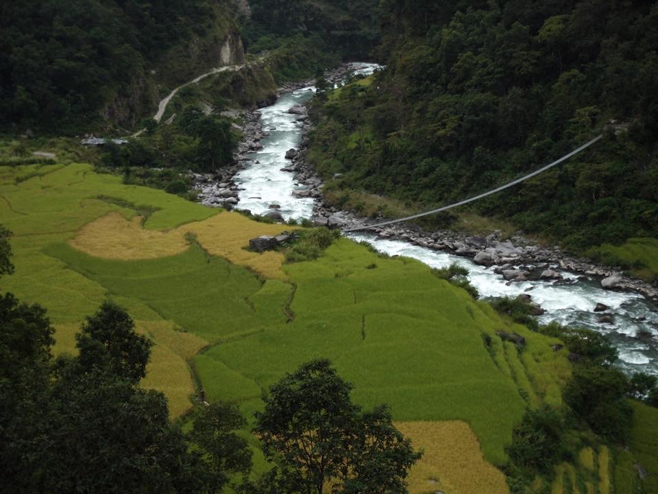 DigiNepal Placesdiginpl.com › places › bung nepal
Bung, Nepal
ठाउँBung is a village development committee in Solukhumbu District in the Sagarmatha Zone of north-eastern Nepal. At the time of the 1991 Nepal census it had a population of 3368 people living in 737 individual households. At the 2011 census,…
DigiNepal Placesdiginpl.com › places › baku nepalBaku, Nepal
ठाउँBaku is a village development committee (VDC) in Solukhumbu District in the Sagarmatha Zone of north-eastern Nepal. Baku lies in the Himalaya, 59 km South of Mount Everest and is bordered by the valleys of the Dudh Kosi River (West)…
DigiNepal Placesdiginpl.com › places › solukhumbu districtSolukhumbu District
ठाउँ…2001. Mount Everest is in the northern part of this district, within Sagarmatha National Park. सोलुखुम्बु जिल्ला, नेपालको पूर्वाञ्चल विकास क्षेत्रको सगरमाथा अञ्चलको उत्तरी भागमा अवस्थित हिमाली जिल्ला हो। विश्व सम्पदा सूचीमा सुचिकृत…

सम्बन्धित खोज
गोपनीयता: नतिजा सुधार्न हामी खोजका शब्द मात्र, जम्मा गणनाका रूपमा राख्छौं। आईपी ठेगाना, खाता वा उपकरण राखिँदैन; व्यक्तिगत विवरण भएका खोज राखिँदैनन्। वेबका नतिजा हाम्रो सर्भरले ल्याउँछ, त्यसैले सेवाप्रदायकले तपाईं को हो थाहा पाउँदैनन्।