
Rautahat District
रौतहट जिल्ला
District of Nepal
नेपालीमा पढ्नुहोस् · हिंदी में पढ़ें
- नेपाली · English · हिंदीRead in your language
- CitedEvery fact sourced
- Ad-freeNo ads, no tracking
Rautahat District (Maithili: रौतहट जिल्ला), a part of Madhesh Province, is one of the seventy-seven districts of Nepal. The district headquarter is Gaur, including municipalities like Katahariya, Garuda, Chandrapur, Paroha, covers an area of 1,126 km2 and had a population of 545,132 in 2001 and 686,722 in 2011. This district has a total of 2 VDCs and 16 municipalities. Among other districts, Rautahat has the largest percent of Muslims in Nepal, about 22.4% (census 2021). The most densely populated village in Rautahat district, Rajpur pharhadwa(राजपुर फरहदवा), is primarily Muslim, but a majority of people in the district are Hindu. Sri Ram Sugar Mill is the only sugar mill located in Garuda municipality. The well known shiva temple located in Shivnagar, which is looked after by Sah and Jha family. The historical temple of Goddess Durga is in Matsari.Every year, the temple welcomes millions of devotees from different parts of Nepal and India as well on the occasion of Navaratri. Late Shri Gulab Narayan Jha, the first person to represent Madhesis in politics, was permanent resident of this village. There is a place called Najarpur in Chandrapur where whole village is vegetarian. They are not even allowed to buy or sell any alcoholic beverages and buying and selling of tobacco products is also prohibited.
Quick facts
- Type
- district of Nepal wd
- Located in
- Madhesh Province (province of Nepal) wd
- Population
- 813,573 (2011) wd
- Area
- 1,126 km² wd
- Official website
- ddcrautahat.gov.np wd
- Coordinates
- 26.9667° N, 85.3000° E wd
About
There is a place called Katahariya which lies in Katahariya Municipality itself. It is famous for katiya meat. Katiya is an earthen pot in which mainly goat meat is cooked with the help of charcoal.
Nunthar is a famous place for picnic and there is a temple of lord shiva which is located in Paurai Bagmati, Rautahat.
Rautahat district is rich in natural resources. There are varieties of trees and varieties of medicinal herbs in the forest of Rautahat. There are dense forest with varieties of wild animals in the forest of Rautahat, including cheetahs, tigers,…
Places in Rautahat District
- Chandrapur Municipality — Place in Madhesh, Nepal
- Katahariya — Municipality in Central, Nepal
- Garuda Municipality — Municipality in Narayani, Nepal
- Kanakpur — Village development committee in Narayani Zone, Nepal
- Akolawa — Place in Nepal
- Dipahi — Village development committee in Narayani Zone, Nepal
- Ajagaibi — Place in Nepal
- Jhunkhunwa — Village development committee in Narayani Zone, Nepal
- Jethrahiya — Village development committee in Narayani Zone, Nepal
- Hathiyahi — Village development committee in Narayani Zone, Nepal
- Rajdevi — Municipality in Central, Nepal
- Khesarhiya — Village development committee in Narayani Zone, Nepal
Nearby places
- Mahamadpur, Rautahat — 3 km
- Garuda Municipality — 3 km
- Pothiyahi — 3 km
- Dudhauli — 3 km
- Pipra Pokhariya — 3 km
- Gamhariya Birta — 4 km
In the news All news →

Related
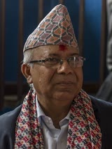 Madhav Kumar Nepal
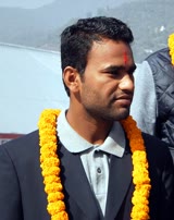 Jitendra Mukhiya
 Prabhu Sah
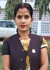 Alka Kumari Jha
 Madhesh Province
Questions
- Where is Rautahat District located?
- Rautahat District is located in Madhesh Province, Nepal.
- What is the population of Rautahat District?
- The population of Rautahat District is 813,573 (as of 2011).
Sources
- Wikipedia (English): Rautahat District · CC BY-SA 4.0
- Wikipedia (Nepali): रौतहट जिल्ला · CC BY-SA 4.0
- Wikidata item Q28098 · CC0 1.0
- Image: Nunthar Shiva Mandir.jpg by Gaurav Dhwaj Khadka (CC BY-SA 4.0)

Last updated · facts checked 7 November 2026
Cite this page
"Rautahat District". DigiNepal. Last updated 3 November 2026. https://diginpl.com/places/rautahat-district. Retrieved 7 November 2026.