
Chandrapur Municipality
चन्द्रनिगाहपुर
From Chandrapur 7 Nayabasti Rautahat Nepal
नेपालीमा पढ्नुहोस् · हिंदी में पढ़ें
- नेपाली · English · हिंदीRead in your language
- CitedEvery fact sourced
- Ad-freeNo ads, no tracking
Chandrapur Municipality (Nepali: चन्द्रपुर), locally known as Chandranigahapur or Chapur, is a municipality in Rautahat District of Madhesh Province of Nepal. Chandrapur municipality lies on the west side of Bagmati River along Chure range, bordering Gujara municipality in the west, Brindawan municipality in south, Bakaiya Rural Municipality & Bagmati Rural Municipality, Makwanpur of Makwanpur District of Bagmati Province in the north and Bagmati municipality of Sarlahi district in the east. The municipality was established on 18 May 2014 by merging Chandranigahapur, Judibela, Paurai, Santpur Matioun, and Dumariya Matioun VDCs.
Quick facts
- Type
- human settlement, municipality of Nepal wd
- Located in
- Rautahat District (district of Nepal) › Madhesh Province (province of Nepal) wd
- Area
- 231 km² wd
- Official website
- chandrapurmun.gov.np wd
- Coordinates
- 27.1588° N, 85.3394° E wd
About
According to the 2011 Nepal census, it had a population of 72,085 people living in 13,445 individual households.
Nearby places
- Ashrang — 5 km
- Judibela — 6 km
- Rangapur, Rautahat — 6 km
- Malta, Lalitpur — 9 km
- Paurai — 11 km
- Dhimal, Nepal — 11 km
In the news All news →

Related
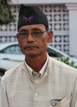 Dhan Lal Thokar
 Mount EverestEarth's highest mountain
 HimalayasMountain range in Asia
 KathmanduCapital and largest city in Nepal
 Kangchenjunga3rd-highest mountain on Earth
 Annapurna (mountain range)Mountain range in the Himalayas
 Dhaulagiri7th-highest mountain on Earth
 Makalu5th-highest mountain on Earth
 Lhotse4th-highest mountain on Earth
 Cho Oyu6th-highest mountain on Earth
 Manaslu8th-highest mountain on Earth
Questions
- Where is Chandrapur Municipality located?
- Chandrapur Municipality is located in Rautahat District, Madhesh Province, Nepal.
Sources
- Wikipedia (English): Chandrapur Municipality · CC BY-SA 4.0
- Wikipedia (Nepali): चन्द्रनिगाहपुर · CC BY-SA 4.0
- Wikidata item Q3414207 · CC0 1.0
- Image: Chapur np.jpg by Nepalopedia4u (CC0)

Last updated · facts checked 4 November 2026
Cite this page
"Chandrapur Municipality". DigiNepal. Last updated 31 October 2026. https://diginpl.com/places/chandrapur-municipality. Retrieved 4 November 2026.