
Phungling Municipality
फुङ्लिङ नगरपालिका
Village development committee
नेपालीमा पढ्नुहोस् · हिंदी में पढ़ें
- नेपाली · English · हिंदीRead in your language
- CitedEvery fact sourced
- Ad-freeNo ads, no tracking
Phungling Municipality is a municipality located in Taplejung District in the Koshi Province of Nepal. The municipality was formed merging the then two Village Development Committees of Phungling and Dokhu in May 2014. At the time of the 2011 Nepal census it had a population of 19,085 people and 4,480 individual households.
Quick facts
- Type
- ward of Nepal, human settlement, municipality of Nepal wd
- Located in
- Taplejung District (district of Nepal) › Koshi Province (province of Nepal) wd
- Elevation
- 1,441 m wd
- Official website
- taplejungmun.gov.np wd
- Coordinates
- 27.3564° N, 87.6703° E wd
Nearby places
- Taplejung District — 1 km
- Dokhu — 2 km
- Taplejung Airport — 3 km
- Hangdeva — 4 km
- Khokling — 5 km
- Phulbari, Taplejung — 5 km
Related
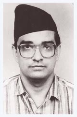 Madan Bhandari
 Rabindra Prasad Adhikari
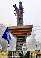 Te-ongsi Sirijunga Xin Thebe
 Nabin Subba
 Mount EverestEarth's highest mountain
 HimalayasMountain range in Asia
 KathmanduCapital and largest city in Nepal
 Kangchenjunga3rd-highest mountain on Earth
 Annapurna (mountain range)Mountain range in the Himalayas
 Dhaulagiri7th-highest mountain on Earth
 Makalu5th-highest mountain on Earth
 Lhotse4th-highest mountain on Earth
Questions
- Where is Phungling Municipality located?
- Phungling Municipality is located in Taplejung District, Koshi Province, Nepal.
- What is the elevation of Phungling Municipality?
- Phungling Municipality is at an elevation of 1,441 m above sea level.
Sources
- Wikipedia (English): Phungling Municipality · CC BY-SA 4.0
- Wikipedia (Nepali): फुङ्लिङ नगरपालिका · CC BY-SA 4.0
- Wikidata item Q668851 · CC0 1.0
- Image: Phungling.JPG by Suryakedem555 (CC BY-SA 4.0)

Last updated · facts checked 7 November 2026
Cite this page
"Phungling Municipality". DigiNepal. Last updated 2 October 2026. https://diginpl.com/places/phungling-municipality. Retrieved 7 November 2026.
Text from the Wikipedia article Phungling Municipality, licensed under CC BY-SA 4.0. This page's text is shared under the same licence. Facts from Wikidata (CC0). Image: Phungling.JPG — Suryakedem555, CC BY-SA 4.0.