
Sarlahi District
सर्लाही जिल्ला
District of Nepal
नेपालीमा पढ्नुहोस् · हिंदी में पढ़ें
- नेपाली · English · हिंदीRead in your language
- CitedEvery fact sourced
- Ad-freeNo ads, no tracking
Sarlahi is one of the seventy-seven districts of Nepal. Being one of eight districts of Madhesh Province, it is an Outer Terai district, which borders Rautahat district to the west, Mahottari district to the east, Sindhuli district to the north, and the Indian state of Bihar to the south. The district, with Malangwa as its headquarter, covers an area of 1,259 km2 (486 sq mi) and has a population of 862,470 in 2021.
Quick facts
- Type
- district of Nepal wd
- Located in
- Madhesh Province (province of Nepal) wd
- Population
- 862,470 (2011) wd
- Area
- 1,259 km² wd
- Official website
- ddcsarlahi.gov.np wd
- Coordinates
- 26.9500° N, 85.5500° E wd
Places in Sarlahi District
- Malangwa — Headquarter of Sarlahi district, Nepal
- Lalbandi — Municipality in Madhesh Province, Nepal
- Balara, Nepal — Municipality in Central, Nepal
- Hariwan — Municipality in Janakpur Zone, Nepal
- Ishwarpur — Municipality in Janakpur, Nepal
- Achalgadh — Place in Nepal
- Haripurwa — Municipality in Madhesh Province, Nepal
- Godaita — Municipality in Central, Nepal
- Kisanpur — Village development committee in Janakpur Zone, Nepal
- Babarganj — Village development committee in Janakpur Zone, Nepal
- Kaudena Rural Municipality — Rural Municipality in Central, Nepal
- Gamhariya, Sarlahi — Village Development Committee in Nepal
Nearby places
- Kabilasi, Sarlahi — 1 km
- Hempur — 3 km
- Pharahadawa — 3 km
- Kisanpur — 4 km
- Jamuniya, Sarlahi — 5 km
- Lakshmipur Kodraha — 6 km
Related
 Giriraj Mani Pokharel
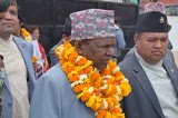 Lal Babu Pandit
 Yash Kumar
 Ashok Kumar Yadav
 Madhesh Province
Questions
- Where is Sarlahi District located?
- Sarlahi District is located in Madhesh Province, Nepal.
- What is the population of Sarlahi District?
- The population of Sarlahi District is 862,470 (as of 2011).
Sources
- Wikipedia (English): Sarlahi District · CC BY-SA 4.0
- Wikipedia (Nepali): सर्लाही जिल्ला · CC BY-SA 4.0
- Wikidata item Q28074 · CC0 1.0
- Image: Bagmati River at Sarlahi.jpg by Gaurav Dhwaj Khadka (CC BY-SA 4.0)

Last updated · facts checked 7 November 2026
Cite this page
"Sarlahi District". DigiNepal. Last updated 2 October 2026. https://diginpl.com/places/sarlahi-district. Retrieved 7 November 2026.
Text from the Wikipedia article Sarlahi District, licensed under CC BY-SA 4.0. This page's text is shared under the same licence. Facts from Wikidata (CC0). Image: Bagmati River at Sarlahi.jpg — Gaurav Dhwaj Khadka, CC BY-SA 4.0.