
Malangwa
मलंगवा नगरपालिका
Municipality in Province No. 2, Nepal
नेपालीमा पढ्नुहोस् · हिंदी में पढ़ें
- नेपाली · English · हिंदीRead in your language
- CitedEvery fact sourced
- Ad-freeNo ads, no tracking
Malangwa is a town, a municipality, and the headquarter of Sarlahi District in Madhesh Province of Nepal. The district's oldest municipality is in Parliamentary Constituency 2. From the Mahendra Highway 25 kilometres (16 mi) south of Nawalpur, a small highway-side town. Situated at an altitude of 79 meters (259 ft) above sea level, Malangwa is near the Indian border at Sonbarsa. There is a customs checkpoint at the border crossing.
Quick facts
- Type
- human settlement, border city, municipality of Nepal wd
- Located in
- Sarlahi District (district of Nepal) › Madhesh Province (province of Nepal) wd
- Population
- 25,102 (2011) wd
- Area
- 30.44 km² wd
- Elevation
- 79 m wd
- Official website
- malangwamun.gov.np wd
- Coordinates
- 26.8667° N, 85.5667° E wd
Nearby places
- Gamhariya, Sarlahi — 2 km
- Musauli — 2 km
- Brahmapuri, Sarlahi — 2 km
- Salempur, Nepal — 3 km
- Tribhuwannagar, Sarlahi — 3 km
- Motipur, Sarlahi — 5 km
Related
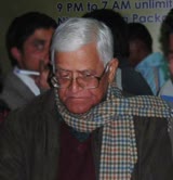 Bishwonath Upadhyaya
 Abdur Rahim MikraniAashiq Ali MikraniSarita Mahato
 Mount EverestEarth's highest mountain
 HimalayasMountain range in Asia
 KathmanduCapital and largest city in Nepal
 Kangchenjunga3rd-highest mountain on Earth
 Annapurna (mountain range)Mountain range in the Himalayas
 Dhaulagiri7th-highest mountain on Earth
 Makalu5th-highest mountain on Earth
 Lhotse4th-highest mountain on Earth
Questions
- Where is Malangwa located?
- Malangwa is located in Sarlahi District, Madhesh Province, Nepal.
- What is the population of Malangwa?
- The population of Malangwa is 25,102 (as of 2011).
- What is the elevation of Malangwa?
- Malangwa is at an elevation of 79 m above sea level.
Sources
- Wikipedia (English): Malangwa · CC BY-SA 4.0
- Wikipedia (Nepali): मलंगवा नगरपालिका · CC BY-SA 4.0
- Wikidata item Q1923693 · CC0 1.0
- Image: Nepal topo en.jpg (CC BY-SA 3.0)

Last updated · facts checked 7 November 2026
Cite this page
"Malangwa". DigiNepal. Last updated 2 October 2026. https://diginpl.com/places/malangwa. Retrieved 7 November 2026.
Text from the Wikipedia article Malangwa, licensed under CC BY-SA 4.0. This page's text is shared under the same licence. Facts from Wikidata (CC0). Image: Nepal topo en.jpg, CC BY-SA 3.0.