
Ramechhap District
रामेछाप जिल्ला
District of Nepal
नेपालीमा पढ्नुहोस् · हिंदी में पढ़ें
- नेपाली · English · हिंदीRead in your language
- CitedEvery fact sourced
- Ad-freeNo ads, no tracking
Ramechhap District (Nepali: रामेछाप जिल्ला), a part of Bagmati Province, is one of the seventy-seven districts of Nepal. The district, also known as Wallo Kirat Ramechhap, has its district headquarters in Manthali and covers an area of 1,546 km2 (597 sq mi). In 2011, the district had a population of 202,646 and population density of 137.4 per km2 (53.1 per sq mi). It has 11 post offices, with the District Post Office bearing the postal code 45400.
Quick facts
- Type
- district of Nepal wd
- Located in
- Bagmati Province (province of Nepal) wd
- Population
- 170,302 (2011) wd
- Area
- 1,546 km² wd
- Official website
- ddcramechhap.gov.np wd
- Coordinates
- 27.3333° N, 86.0833° E wd
About
According to EHRP Nepal, the district is made up of eight local municipalities:
Manthali Municipality
Ramechhap Municipality
Umakunda Rural Municipality
Places in Ramechhap District
- Ramechhap, Ramechhap — Place in Bagmati, Nepal
- Ramechhap Airport — Airport
- Manthali, Ramechhap — Municipality in Bagmati, Nepal
- Namadi — Village development committee in Janakpur Zone, Nepal
- Dimipokhari — Place in Janakpur Zone, Nepal
- Bethan, Nepal — Village development committee in Janakpur Zone, Nepal
- Rampur, Ramechhap — Village development committee in Janakpur Zone, Nepal
- Pakarbas — Village development committee in Janakpur Zone, Nepal
- Rasanalu — Village development committee in Janakpur Zone, Nepal
- Khimti — Village development committee in Janakpur Zone, Nepal
- Gumdel — Village development committee in Bagmati Province, Nepal
- Dadhuwa — Village development committee in Janakpur Zone, Nepal
Nearby places
- Ramechhap, Ramechhap — 0 km
- Sunarpani — 3 km
- Sukajor — 5 km
- Manthali, Ramechhap — 5 km
- Salupati — 6 km
- Maluwajor — 7 km
Related
 Pushpa Lal Shrestha
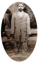 Krishna Lal Adhikari
 Sudarshan Gautam
 Mount EverestEarth's highest mountain
 HimalayasMountain range in Asia
 KathmanduCapital and largest city in Nepal
 Kangchenjunga3rd-highest mountain on Earth
 Annapurna (mountain range)Mountain range in the Himalayas
 Dhaulagiri7th-highest mountain on Earth
 Makalu5th-highest mountain on Earth
 Lhotse4th-highest mountain on Earth
 Cho Oyu6th-highest mountain on Earth
Questions
- Where is Ramechhap District located?
- Ramechhap District is located in Bagmati Province, Nepal.
- What is the population of Ramechhap District?
- The population of Ramechhap District is 170,302 (as of 2011).
Sources
- Wikipedia (English): Ramechhap District · CC BY-SA 4.0
- Wikipedia (Nepali): रामेछाप जिल्ला · CC BY-SA 4.0
- Wikidata item Q28611 · CC0 1.0
- Image: Pancha Pokhari,Ramechhap130811IMG 23560005.JPG by Bijaya2043 (CC BY-SA 3.0)

Last updated · facts checked 7 November 2026
Cite this page
"Ramechhap District". DigiNepal. Last updated 2 November 2026. https://diginpl.com/places/ramechhap-district. Retrieved 7 November 2026.