Kapan, Nepal
कपन
Human settlement in Nepal
नेपालीमा पढ्नुहोस् · हिंदी में पढ़ें
- नेपाली · English · हिंदीRead in your language
- CitedEvery fact sourced
- Ad-freeNo ads, no tracking
Kapan is a residential area and former Village Development Committee that is now part of Budanilkantha Municipality in Kathmandu District in Province No. 3 of central Nepal. It is situated in the northern part of Kathmandu. At the time of the 2011 Nepal census it had a population of 48,463 in 12,324 households. Kapan Sangit Sarowar, Kapan Monastery, Kapan Aani Gumba etc. are tourist places situated at Kapan. Kapan consists of several settlements, e. g.: Mahankal, New Colony, Jyotinagar, Saraswatinagar, Golphutar or Baluwakhani. Kapan has recently developed very high number of Paying Guest Houses for local-tourism.
Quick facts
- Type
- human settlement wd
- Located in
- Kathmandu District (district of Nepal) › Bagmati Province (province of Nepal) wd
- Coordinates
- 27.7400° N, 85.3700° E wd
Nearby places
- Kopan Monastery — 1 km
- Chunikhel — 2 km
- Boudha Stupa — 2 km
- Mahankal, Kathmandu — 2 km
- Jorpati — 2 km
- Taragaon Museum — 3 km
Related
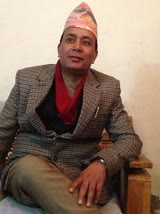 Gyanendra Deuja
 Mount EverestEarth's highest mountain
 HimalayasMountain range in Asia
 KathmanduCapital and largest city in Nepal
 Kangchenjunga3rd-highest mountain on Earth
 Annapurna (mountain range)Mountain range in the Himalayas
 Dhaulagiri7th-highest mountain on Earth
 Makalu5th-highest mountain on Earth
 Lhotse4th-highest mountain on Earth
 Cho Oyu6th-highest mountain on Earth
 Manaslu8th-highest mountain on Earth
 PokharaMetropolitan city in Gandaki Province, Nepal
Questions
- Where is Kapan, Nepal located?
- Kapan, Nepal is located in Kathmandu District, Bagmati Province, Nepal.
Sources
- Wikipedia (English): Kapan, Nepal · CC BY-SA 4.0
- Wikipedia (Nepali): कपन · CC BY-SA 4.0
- Wikidata item Q3425243 · CC0 1.0
Last updated · facts checked 5 November 2026
Cite this page
"Kapan, Nepal". DigiNepal. Last updated 5 November 2026. https://diginpl.com/places/kapan-nepal. Retrieved 5 November 2026.