
Ilam Municipality
इलाम नगरपालिका
Municipality in Ilam District, Nepal
नेपालीमा पढ्नुहोस् · हिंदी में पढ़ें
- नेपाली · English · हिंदीRead in your language
- CitedEvery fact sourced
- Ad-freeNo ads, no tracking
Ilam (Nepali: इलाम ) is one of four urban municipalities of Ilam District, which lies in the Mahabharata hilly range of Koshi Province, eastern Nepal. Ilam also acts as the headquarters of Ilam District. Being the largest producer region for Nepali tea, its tea farms are a major tourist attraction in Koshi Province. Ilam is also famous for its natural scenery and landscapes as well as its diverse agricultural economy which specializes in horticultural crop production.
Quick facts
- Type
- municipality of Nepal wd
- Located in
- Ilam District (district of Nepal) › Koshi Province (province of Nepal) wd
- Population
- 48,563 (2011) wd
- Coordinates
- 26.9079° N, 87.9258° E wd
About
The total area of the municipality is 173.32 square kilometres (66.92 sq mi) and the total population is 48,536 as per the 2011 Nepal census. The municipality is divided into 12 wards. The 74 kilometer section of Mechi highway connects Ilam with the east–west highway and subsequently, with the provincial capital of Biratnagar.
Nearby places
- Ilam District — 1 km
- Shantidanda — 3 km
- Barbote — 5 km
- Godak — 5 km
- Sangrumba — 6 km
- Namsaling — 7 km
Related
 Nawayug Shrestha
 Hangyug Agyat
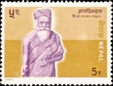 Gyandil Das
 Shreedev Bhattarai
 Mount EverestEarth's highest mountain
 HimalayasMountain range in Asia
 KathmanduCapital and largest city in Nepal
 Kangchenjunga3rd-highest mountain on Earth
 Annapurna (mountain range)Mountain range in the Himalayas
 Dhaulagiri7th-highest mountain on Earth
 Makalu5th-highest mountain on Earth
 Lhotse4th-highest mountain on Earth
Questions
- Where is Ilam Municipality located?
- Ilam Municipality is located in Ilam District, Koshi Province, Nepal.
- What is the population of Ilam Municipality?
- The population of Ilam Municipality is 48,563 (as of 2011).
Sources
- Wikipedia (English): Ilam Municipality · CC BY-SA 4.0
- Wikipedia (Nepali): इलाम नगरपालिका · CC BY-SA 4.0
- Wikidata item Q950072 · CC0 1.0
- Image: Ilam green.jpg by Hari gurung77 (CC BY-SA 4.0)

Last updated · facts checked 7 November 2026
Cite this page
"Ilam Municipality". DigiNepal. Last updated 4 November 2026. https://diginpl.com/places/ilam-municipality. Retrieved 7 November 2026.