
Gorkha District
गोरखा जिल्ला
District of Nepal
नेपालीमा पढ्नुहोस् · हिंदी में पढ़ें
- नेपाली · English · हिंदीRead in your language
- CitedEvery fact sourced
- Ad-freeNo ads, no tracking
Gorkha District (Nepali: गोरखा जिल्ला, romanized: Gōrkhā Jillā) is a district in Gandaki Province, located in central Nepal. It is one of the seventy-seven districts of Nepal and covers an area of 3,610 km2 (1,390 sq mi), making it the fourth-largest district in Nepal by area. According to the 2021 Nepal Census, the district has an population of 252,201. Its administrative headquarters is Gorkha Municipality.
Quick facts
- Type
- district of Nepal wd
- Located in
- Gandaki Province (province of Nepal) wd
- Population
- 251,027 (2011) wd
- Area
- 3,610 km² wd
- Official website
- ddcgorkha.gov.np wd
- Coordinates
- 28.2833° N, 84.6833° E wd
About
Gorkha holds a prominent place in Nepalese history as the homeland of Prithvi Narayan Shah and the center of the former Gorkha Kingdom, from which the Unification of Nepal began in the 25 September 1744. The district is also closely associated with the Gurkha soldiers, whose name is derived from Gorkha.
The district is home to several important religious and cultural sites, including Manakamana Temple, Gorakhnath Temple, and Gorakh Kali Temple. Major rivers flowing through the district include the Budhi Gandaki, Chepe, Daraudi, Marshyangdi, and Trishuli rivers. Gorkha shares border with Dhading, Lamjung, Chitwan and Tanahu.
Places in Gorkha District
- Manaslu — 8th-highest mountain on Earth
- Gorkha Municipality — Municipality in Gandaki Province, Nepal
- Manakamana Temple — Temple in Gorkha, Nepal
- Aarupokhari — Village development committee in Gandaki Zone, Nepal
- Ghyalchok — Village in Gandaki Province, Nepal
- Kerauja — Village development committee in Gandaki Zone, Nepal
- Chumchet — Village development committee in Gandaki Zone, Nepal
- Lho — Village development committee in Gandaki Zone, Nepal
- Laprak — Former Village development committee in Gandaki Province, Nepal
- Samagaun — Village development committee in Gandaki Zone, Nepal
- Aaru Chanuate — Place in Nepal
- Dhawa, Nepal — Village development committee in Gandaki Zone, Nepal
Nearby places
- Ghyachok — 5 km
- Kharibot — 6 km
- Dudhpokhari — 7 km
- 2015 Mount Everest avalanches — 7 km
- Laprak — 9 km
- Warpak — 10 km
In the news All news →
Related
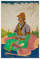 Bhimsen Thapa
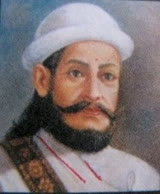 Amar Singh Thapa
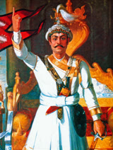 Prithvi Narayan Shah
 Sunil Babu Pant
 Narayan Kaji Shrestha
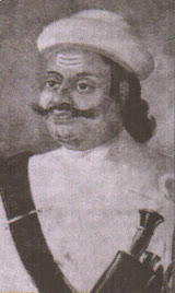 Kalu Pande
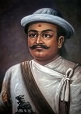 Vamsharaj Pande
 Ram Pratap Thapa
 Gandaki Province
Questions
- Where is Gorkha District located?
- Gorkha District is located in Gandaki Province, Nepal.
- What is the population of Gorkha District?
- The population of Gorkha District is 251,027 (as of 2011).
Sources
- Wikipedia (English): Gorkha District · CC BY-SA 4.0
- Wikipedia (Nepali): गोरखा जिल्ला · CC BY-SA 4.0
- Wikidata item Q28476 · CC0 1.0
- Image: Gorkha Palace durbar.jpg by Anuj Devkota (CC BY-SA 4.0)

Last updated · facts checked 7 November 2026
Cite this page
"Gorkha District". DigiNepal. Last updated 6 November 2026. https://diginpl.com/places/gorkha-district. Retrieved 7 November 2026.