
Dhikur Pokhari
ढिकुरपोखरी
Geographical object
नेपालीमा पढ्नुहोस् · हिंदी में पढ़ें
- नेपाली · English · हिंदीRead in your language
- CitedEvery fact sourced
- Ad-freeNo ads, no tracking
Dhikurpokhari is a suburb and former Village Development Committee in Kaski District in the Gandaki Province of northern-central Nepal. At the 1991 Nepal census, it had a population of 7,392 persons in 1,427 individual households.
Quick facts
- Type
- ward of Nepal wd
- Located in
- Kaski District (district of Nepal) › Gandaki Province (province of Nepal) wd
- Coordinates
- 28.2800° N, 83.8500° E wd
About
Dhikurpokhari is surrounded by Machhapuchchhre Rural Municipality on the East, Myagdi district on the West, Manang District on the North and Parbat district, and Pokhara Metropolitan City on the South. It has a total area of 417.74 km2 (161.29 sq mi) and a population of 23,565 individuals, according to Nepal census 2011 (2068 BS). The population density of this Rural Municipality is 56.411/km2 (146.103/sq mi). This Rural Municipality is divided into 8 wards. This rural municipality lies 4528 feet above sea level. The Mid-Hill Highway(Pokhara-Baglung Segment) goes through the Dhikurpokhari.
There are views of the Annapurna range. It is the birthplace of current Prime Minister of Nepal, Prachanda.
Nearby places
- Dhampus — 3 km
- Bhadaure Tamagi — 3 km
- Kaskikot — 5 km
- Dhital, Nepal — 5 km
- Salyan, Kaski — 6 km
- Chitre — 7 km
Related
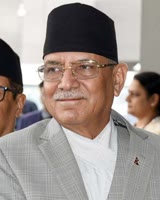 Pushpa Kamal DahalRam Karki
 Mount EverestEarth's highest mountain
 HimalayasMountain range in Asia
 KathmanduCapital and largest city in Nepal
 Kangchenjunga3rd-highest mountain on Earth
 Annapurna (mountain range)Mountain range in the Himalayas
 Dhaulagiri7th-highest mountain on Earth
 Makalu5th-highest mountain on Earth
 Lhotse4th-highest mountain on Earth
 Cho Oyu6th-highest mountain on Earth
 Manaslu8th-highest mountain on Earth
Questions
- Where is Dhikur Pokhari located?
- Dhikur Pokhari is located in Kaski District, Gandaki Province, Nepal.
Sources
- Wikipedia (English): Dhikur Pokhari · CC BY-SA 4.0
- Wikipedia (Nepali): ढिकुरपोखरी · CC BY-SA 4.0
- Wikidata item Q630731 · CC0 1.0
- Image: Naudanda.jpg by Apazo (CC BY 2.0)

Last updated · facts checked 4 November 2026
Cite this page
"Dhikur Pokhari". DigiNepal. Last updated 31 October 2026. https://diginpl.com/places/dhikur-pokhari. Retrieved 4 November 2026.