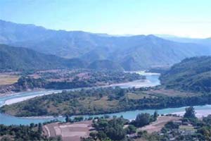
Chapakot Municipality
चापाकोट
Municipality in Syangja District, Nepal
नेपालीमा पढ्नुहोस् · हिंदी में पढ़ें
- नेपाली · English · हिंदीRead in your language
- CitedEvery fact sourced
- Ad-freeNo ads, no tracking
Chapakot is a municipality in the southeastern part of Syangja District in Gandaki Province of central Nepal. The new municipality was formed by merging three existing villages—Ratnapur, Kuwakot and Chapakot—on 18 May 2014. On 12 March 2017 the government implemented the new local administrative structure consisting of 744 local units. With the implementation of this new local administrative structure, the old structure will no longer be in existence. According to the new structure, VDCs will be replaced with village councils. Newly merged VDCs are Sankhar, Sekham, Ward no. 8 of Pakbadi & Ward no. of Malyangkot. The office of the municipality is that of the former Chapakot Municipality.
Quick facts
- Type
- municipality of Nepal wd
- Located in
- Syangja District (district of Nepal) › Gandaki Province (province of Nepal) wd
- Area
- 120.59 km² wd
- Official website
- chapakotmun.gov.np wd
- Coordinates
- 27.8833° N, 83.8333° E wd
Places in Chapakot Municipality
- Sankhar — Village development committee in Gandaki Province, Nepal
- Bhattarai Danda — Town in Syangja District, Nepal
Nearby places
- Ratnapur, Syangja — 2 km
- Khaliban — 3 km
- Rampur, Palpa — 5 km
- Kuwakot, Syangja — 5 km
- Sekham — 6 km
- Keware Bhanjyang — 7 km
Related
 Bishnu Majhi
 Mount EverestEarth's highest mountain
 HimalayasMountain range in Asia
 KathmanduCapital and largest city in Nepal
 Kangchenjunga3rd-highest mountain on Earth
 Annapurna (mountain range)Mountain range in the Himalayas
 Dhaulagiri7th-highest mountain on Earth
 Makalu5th-highest mountain on Earth
 Lhotse4th-highest mountain on Earth
 Cho Oyu6th-highest mountain on Earth
 Manaslu8th-highest mountain on Earth
 PokharaMetropolitan city in Gandaki Province, Nepal
Questions
- Where is Chapakot Municipality located?
- Chapakot Municipality is located in Syangja District, Gandaki Province, Nepal.
Sources
- Wikipedia (English): Chapakot Municipality · CC BY-SA 4.0
- Wikipedia (Nepali): चापाकोट · CC BY-SA 4.0
- Wikidata item Q5072905 · CC0 1.0
- Image: Chapakot Municipality.jpg by Chapakot Municipality (CC BY-SA 4.0)

Last updated · facts checked 7 November 2026
Cite this page
"Chapakot Municipality". DigiNepal. Last updated 2 October 2026. https://diginpl.com/places/chapakot-municipality. Retrieved 7 November 2026.