
Pangboche
Village in Solukhumbu District, Nepal
- नेपाली · EnglishRead in your language
- CitedEvery fact sourced
- Ad-freeNo ads, no tracking
Pangboche or Panboche is a village in Khumjung Village Development Committee of Solukhumbu District in Province No. 1 of Nepal at an altitude of 13,074 feet (3,985 m). It is located high in the Himalayas in the Imja Khole valley, about 3 kilometres northeast of Tengboche and is a base camp for climbing the nearby Ama Dablam and trekking. It contains a monastery, famed for its purported yeti scalp and hand, the latter of which was stolen. The village is inhabited mainly by Sherpas, and Sungdare Sherpa, a native of the village, held the record for summiting Everest five times in the Sherpa climbing history and in the world history of mountaineering in 1989. The Pangboche school was built by Sir Edmund Hillary's Himalayan Trust in 1963. North of the village is the Dughla lake and pass.
Quick facts
- Type
- village wd
- Located in
- Khumbu Pasanglhamu (rural municipality of Nepal) › Solukhumbu District (district of Nepal) › Koshi Province (province of Nepal) wd
- Elevation
- 3,985 m wd
- Coordinates
- 27.8564° N, 86.7897° E wd
Nearby places
- Tengboche — 3 km
- Tengboche Monastery — 3 km
- Taboche — 5 km
- Imja Khola — 5 km
- Pheriche — 5 km
- Dingboche — 6 km
Related
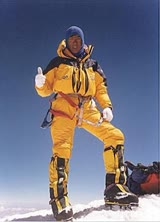 Ang Dorje Sherpa
 Mount EverestEarth's highest mountain
 HimalayasMountain range in Asia
 KathmanduCapital and largest city in Nepal
 Kangchenjunga3rd-highest mountain on Earth
 Annapurna (mountain range)Mountain range in the Himalayas
 Dhaulagiri7th-highest mountain on Earth
 Makalu5th-highest mountain on Earth
 Lhotse4th-highest mountain on Earth
 Cho Oyu6th-highest mountain on Earth
 Manaslu8th-highest mountain on Earth
 PokharaMetropolitan city in Gandaki Province, Nepal
Questions
- Where is Pangboche located?
- Pangboche is located in Khumbu Pasanglhamu, Solukhumbu District, Koshi Province, Nepal.
- What is the elevation of Pangboche?
- Pangboche is at an elevation of 3,985 m above sea level.
Sources
- Wikipedia (English): Pangboche · CC BY-SA 4.0
- Wikidata item Q7130918 · CC0 1.0
- Image: Pangboche.JPG by Moralist (CC BY-SA 3.0)

Last updated · facts checked 3 November 2026
Cite this page
"Pangboche". DigiNepal. Last updated 31 October 2026. https://diginpl.com/places/pangboche. Retrieved 3 November 2026.