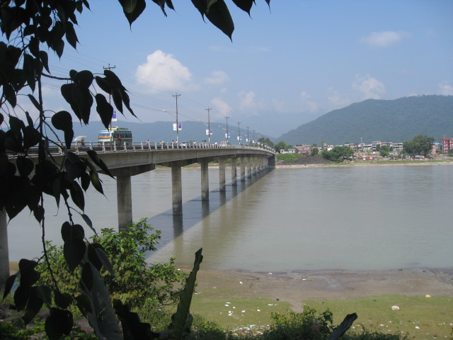
Narayani Bridge
नारायणी पुल
Bridge in Nepal
नेपालीमा पढ्नुहोस् · हिंदी में पढ़ें
- नेपाली · English · हिंदीRead in your language
- CitedEvery fact sourced
- Ad-freeNo ads, no tracking
Narayani Bridge is a bridge on the east–west of Nepal located in the central region of Nepal. The bridge connects Gaindakot municipality of Nawalparasi District on the western region of Nepal, with Narayanghat city on the central development region. Built in the early 1980s, the bridge is roughly 420 m (1,380 ft) long and is considered one of the most important commercial travel routes in the country due to its passage over the Narayani River. It has 15 large and round shaped pillars.
Quick facts
- Type
- bridge wd
- Located in
- Bharatpur (big city) › Chitwan District (district of Nepal) › Bagmati Province (province of Nepal) wd
- Coordinates
- 27.6995° N, 84.4190° E wd
Nearby places
- Gaindakot Municipality — 1 km
- Bharatpur, Nepal — 2 km
- Bharatpur Airport — 3 km
- Maula Kalika Temple — 3 km
- Devghat — 4 km
- Trishuli River — 5 km
In the news All news →
Related
 Mount EverestEarth's highest mountain
 HimalayasMountain range in Asia
 KathmanduCapital and largest city in Nepal
 Kangchenjunga3rd-highest mountain on Earth
 Annapurna (mountain range)Mountain range in the Himalayas
 Dhaulagiri7th-highest mountain on Earth
 Makalu5th-highest mountain on Earth
 Lhotse4th-highest mountain on Earth
 Cho Oyu6th-highest mountain on Earth
 Manaslu8th-highest mountain on Earth
 PokharaMetropolitan city in Gandaki Province, Nepal
 LumbiniHistorical city in Lumbini Province, Nepal
Questions
- Where is Narayani Bridge located?
- Narayani Bridge is located in Bharatpur, Chitwan District, Bagmati Province, Nepal.
Sources
- Wikipedia (English): Narayani Bridge · CC BY-SA 4.0
- Wikipedia (Nepali): नारायणी पुल · CC BY-SA 4.0
- Wikidata item Q16270898 · CC0 1.0
- Image: Narayani bridge in Gaindakot.jpg by 南アジア (CC BY-SA 3.0)

Last updated · facts checked 3 November 2026
Cite this page
"Narayani Bridge". DigiNepal. Last updated 31 October 2026. https://diginpl.com/places/narayani-bridge. Retrieved 4 November 2026.
Text from the Wikipedia article Narayani Bridge, licensed under CC BY-SA 4.0. This page's text is shared under the same licence. Facts from Wikidata (CC0). Image: Narayani bridge in Gaindakot.jpg — 南アジア, CC BY-SA 3.0.