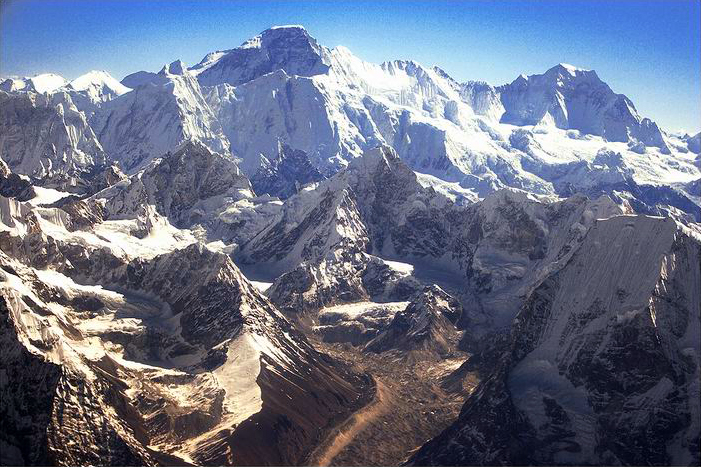
Nangpai Gosum
नङपाई हिमाल
Mountain in the Himalayas
नेपालीमा पढ्नुहोस् · हिंदी में पढ़ें
- नेपाली · English · हिंदीRead in your language
- CitedEvery fact sourced
- Ad-freeNo ads, no tracking
Nangpai Gosum (also known as 'Jasamba') is a mountain in the Himalayas. Its official Nepali name is 'Pasang Lhamu', after the first Sherpani to summit Everest.
Quick facts
- Type
- mountain wd
- Elevation
- 7,350 m wd
- Prominence
- 426 m wd
- Mountain range
- Mahalangur Himal wd
- Coordinates
- 28.0667° N, 86.6000° E wd
About
It lies on the border between Nepal and China. The total elevation of the mountain is 7,351 m (24,117 ft). The first ascent to the summit was a Japanese expedition on October 12, 1986.
Nearby places
- Lunag Ri — 5 km
- Cho Oyu — 7 km
- Tenzing Peak — 9 km
- Gokyo Lakes — 12 km
- Ngozumpa glacier — 12 km
- Gokyo Ri — 14 km
Related
 Mount EverestEarth's highest mountain
 HimalayasMountain range in Asia
 KathmanduCapital and largest city in Nepal
 Kangchenjunga3rd-highest mountain on Earth
 Annapurna (mountain range)Mountain range in the Himalayas
 Dhaulagiri7th-highest mountain on Earth
 Makalu5th-highest mountain on Earth
 Lhotse4th-highest mountain on Earth
 Cho Oyu6th-highest mountain on Earth
 Manaslu8th-highest mountain on Earth
 PokharaMetropolitan city in Gandaki Province, Nepal
 LumbiniHistorical city in Lumbini Province, Nepal
Questions
- What is the elevation of Nangpai Gosum?
- Nangpai Gosum is at an elevation of 7,350 m above sea level.
Sources
- Wikipedia (English): Nangpai Gosum · CC BY-SA 4.0
- Wikipedia (Nepali): नङपाई हिमाल · CC BY-SA 4.0
- Wikidata item Q4312814 · CC0 1.0
- Image: Cho Oyu, Nepal.jpg by en:User:Swinelin (Public domain)

Last updated · facts checked 7 November 2026
Cite this page
"Nangpai Gosum". DigiNepal. Last updated 31 October 2026. https://diginpl.com/places/nangpai-gosum. Retrieved 7 November 2026.
Text from the Wikipedia article Nangpai Gosum, licensed under CC BY-SA 4.0. This page's text is shared under the same licence. Facts from Wikidata (CC0). Image: Cho Oyu, Nepal.jpg — en:User:Swinelin, Public domain.