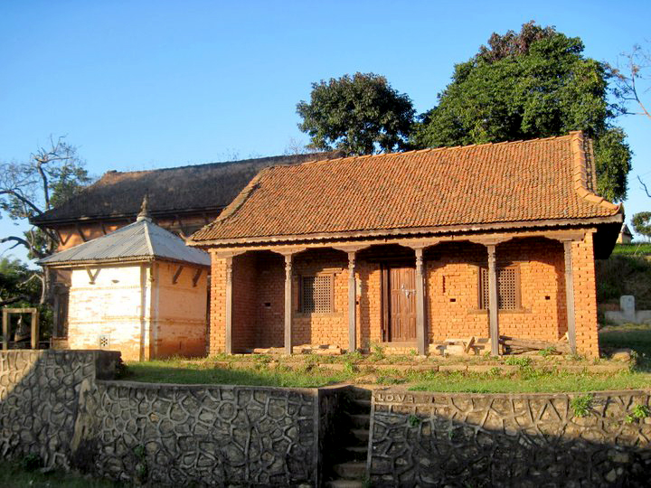
Mathurapati Fulbari
मथुरापाटी फूलबारी
Village development committee in Bagmati Zone, Nepal
नेपालीमा पढ्नुहोस् · हिंदी में पढ़ें
- नेपाली · English · हिंदीRead in your language
- CitedEvery fact sourced
- Ad-freeNo ads, no tracking
Mathurapati Phulbari is a village development committee in Kabhrepalanchok District in the Bagmati Zone of central Nepal. At the time of the 1991 Nepal census it had a population of 4,565. The village is situated 45 km east from capital city Kathmandu. It is situated in the upper belt of the B.P Highway which joins Capital to Eastern Terai in the shortest route. The village has a mixed community including several ethnic groups staying in harmony. The main castes living in Phulbari are Brahmins, Chhetris, Tamangs, Newars and other castes. Nowadays Fulbari VDC is included in Dapcha Kashikanda municipality. Fulbari VDC main industry area is Bhakundebesi.
Quick facts
- Type
- ward of Nepal wd
- Located in
- Kavrepalanchok District (district of Nepal) › Bagmati Province (province of Nepal) wd
- Coordinates
- 27.5800° N, 85.6200° E wd
Nearby places
- Patalekhet — 3 km
- Puranogaun Dapcha — 4 km
- Kavre Nitya Chandeswori — 4 km
- Deuvumi Baluwa — 4 km
- Simalchour Syampati — 5 km
- Methinkot — 5 km
Related
 Mount EverestEarth's highest mountain
 HimalayasMountain range in Asia
 KathmanduCapital and largest city in Nepal
 Kangchenjunga3rd-highest mountain on Earth
 Annapurna (mountain range)Mountain range in the Himalayas
 Dhaulagiri7th-highest mountain on Earth
 Makalu5th-highest mountain on Earth
 Lhotse4th-highest mountain on Earth
 Cho Oyu6th-highest mountain on Earth
 Manaslu8th-highest mountain on Earth
 PokharaMetropolitan city in Gandaki Province, Nepal
 LumbiniHistorical city in Lumbini Province, Nepal
Questions
- Where is Mathurapati Fulbari located?
- Mathurapati Fulbari is located in Kavrepalanchok District, Bagmati Province, Nepal.
Sources
- Wikipedia (English): Mathurapati Fulbari · CC BY-SA 4.0
- Wikipedia (Nepali): मथुरापाटी फूलबारी · CC BY-SA 4.0
- Wikidata item Q3420246 · CC0 1.0
- Image: Mathurapati.jpg by Nirmal Dulal (CC BY-SA 3.0)

Last updated · facts checked 3 November 2026
Cite this page
"Mathurapati Fulbari". DigiNepal. Last updated 31 October 2026. https://diginpl.com/places/mathurapati-fulbari. Retrieved 3 November 2026.