
Katunje
कटुञ्जे, ओखलढुङ्गा
Village development committee in Sagarmatha Zone, Nepal
नेपालीमा पढ्नुहोस् · हिंदी में पढ़ें
- नेपाली · English · हिंदीRead in your language
- CitedEvery fact sourced
- Ad-freeNo ads, no tracking
Katunje is a village development committee in Okhaldhunga District in the Sagarmatha Zone of mid-eastern Nepal. At the time of the 1991 Nepal census, it had a population of 4027 living in 824 individual households.
Quick facts
- Type
- ward of Nepal wd
- Located in
- Okhaldhunga District (district of Nepal) › Koshi Province (province of Nepal) wd
- Population
- 4,229 (2011) wd
- Coordinates
- 27.3200° N, 86.4000° E wd
About
One of the major weekly markets of Okhaldhunga, Kosh Haat lies in Katunje VDC. Presently Katunje lies in Sunkoshi Rural Municipality within Okhaldhunga.
Nearby places
Related
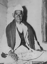 Chakrapani Chalise
 Mount EverestEarth's highest mountain
 HimalayasMountain range in Asia
 KathmanduCapital and largest city in Nepal
 Kangchenjunga3rd-highest mountain on Earth
 Annapurna (mountain range)Mountain range in the Himalayas
 Dhaulagiri7th-highest mountain on Earth
 Makalu5th-highest mountain on Earth
 Lhotse4th-highest mountain on Earth
 Cho Oyu6th-highest mountain on Earth
 Manaslu8th-highest mountain on Earth
 PokharaMetropolitan city in Gandaki Province, Nepal
Questions
- Where is Katunje located?
- Katunje is located in Okhaldhunga District, Koshi Province, Nepal.
- What is the population of Katunje?
- The population of Katunje is 4,229 (as of 2011).
Sources
- Wikipedia (English): Katunje · CC BY-SA 4.0
- Wikipedia (Nepali): कटुञ्जे, ओखलढुङ्गा · CC BY-SA 4.0
- Wikidata item Q3420292 · CC0 1.0
- Image: Katunje.jpg by Manish50 (CC BY-SA 4.0)

Last updated · facts checked 3 November 2026
Cite this page
"Katunje". DigiNepal. Last updated 31 October 2026. https://diginpl.com/places/katunje. Retrieved 3 November 2026.
Text from the Wikipedia article Katunje, licensed under CC BY-SA 4.0. This page's text is shared under the same licence. Facts from Wikidata (CC0). Image: Katunje.jpg — Manish50, CC BY-SA 4.0.