Jangkot
जंकोत
Village development committee in Rapti Zone, Nepal
नेपालीमा पढ्नुहोस् · हिंदी में पढ़ें
- नेपाली · English · हिंदीRead in your language
- CitedEvery fact sourced
- Ad-freeNo ads, no tracking
Jankot is the village development committee in Rolpa District in the Rapti Zone of north-eastern Nepal. At the time of the 2011 Nepal census it had a population of 2853 people living in 599 individual households.
Quick facts
- Type
- ward of Nepal wd
- Located in
- Rolpa District (district of Nepal) › Lumbini Province (province of Nepal) wd
- Coordinates
- 28.4100° N, 82.5500° E wd
Nearby places
- Hwama — 4 km
- Rangsi, Rolpa — 5 km
- Rolpa District — 5 km
- Karchawang — 6 km
- Talawang — 7 km
- Kureli — 8 km
Related
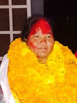 Barsaman Pun
 Mount EverestEarth's highest mountain
 HimalayasMountain range in Asia
 KathmanduCapital and largest city in Nepal
 Kangchenjunga3rd-highest mountain on Earth
 Annapurna (mountain range)Mountain range in the Himalayas
 Dhaulagiri7th-highest mountain on Earth
 Makalu5th-highest mountain on Earth
 Lhotse4th-highest mountain on Earth
 Cho Oyu6th-highest mountain on Earth
 Manaslu8th-highest mountain on Earth
 PokharaMetropolitan city in Gandaki Province, Nepal
Questions
- Where is Jangkot located?
- Jangkot is located in Rolpa District, Lumbini Province, Nepal.
Sources
- Wikipedia (English): Jangkot · CC BY-SA 4.0
- Wikipedia (Nepali): जंकोत · CC BY-SA 4.0
- Wikidata item Q3412474 · CC0 1.0
Last updated · facts checked 3 November 2026
Cite this page
"Jangkot". DigiNepal. Last updated 31 October 2026. https://diginpl.com/places/jangkot. Retrieved 3 November 2026.
Text from the Wikipedia article Jangkot, licensed under CC BY-SA 4.0. This page's text is shared under the same licence. Facts from Wikidata (CC0).