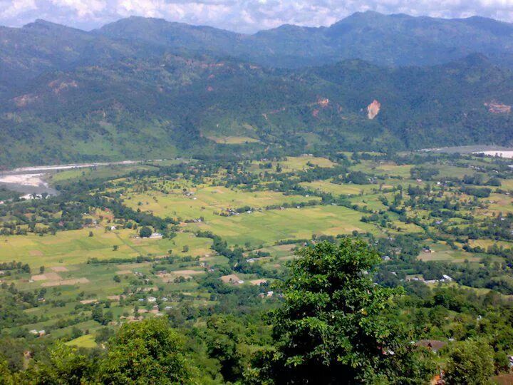
Dedgaun
डेढगाउं
Village development committee in Lumbini Zone, Nepal
- नेपाली · EnglishRead in your language
- CitedEvery fact sourced
- Ad-freeNo ads, no tracking
Dedhgaun (or Dedgaun) is a Ward in Nawalparasi District in the Gandaki Province of southern Nepal. At the time of the 2021 Nepal census it had a population of 4209 people living in 513 individual households.
Quick facts
- Type
- ward of Nepal wd
- Located in
- Nawalparasi District (district of Nepal) › Lumbini Zone (zone of Nepal) › Western Development Region (development region of Nepal) wd
- Coordinates
- 27.8500° N, 84.0800° E wd
About
Dedgaun lies on the bank of the Holy Kali Gandaki River and is surrounded by mountains in all sides.
The Dedgaun area, including the new hydro-electricity project at Baundi Khola, was heavily damaged by floods in September 2008.
Nearby places
- Mithukaram — 2 km
- Rakuwa — 3 km
- Naram — 6 km
- Samungbhagawati — 6 km
- Ramjakot — 6 km
- Bharatipur — 6 km
In the news All news →
Related
 Mount EverestEarth's highest mountain
 HimalayasMountain range in Asia
 KathmanduCapital and largest city in Nepal
 Kangchenjunga3rd-highest mountain on Earth
 Annapurna (mountain range)Mountain range in the Himalayas
 Dhaulagiri7th-highest mountain on Earth
 Makalu5th-highest mountain on Earth
 Lhotse4th-highest mountain on Earth
 Cho Oyu6th-highest mountain on Earth
 Manaslu8th-highest mountain on Earth
 PokharaMetropolitan city in Gandaki Province, Nepal
 LumbiniHistorical city in Lumbini Province, Nepal
Questions
- Where is Dedgaun located?
- Dedgaun is located in Nawalparasi District, Lumbini Zone, Western Development Region, Nepal.
Sources
- Wikipedia (English): Dedgaun · CC BY-SA 4.0
- Wikidata item Q3411900 · CC0 1.0
- Image: Dedhgaun VDC.jpg by Infourmagar (CC BY-SA 4.0)

Last updated · facts checked 4 November 2026
Cite this page
"Dedgaun". DigiNepal. Last updated 31 October 2026. https://diginpl.com/places/dedgaun. Retrieved 4 November 2026.
Text from the Wikipedia article Dedgaun, licensed under CC BY-SA 4.0. This page's text is shared under the same licence. Facts from Wikidata (CC0). Image: Dedhgaun VDC.jpg — Infourmagar, CC BY-SA 4.0.