
Darchula District
दार्चुला जिल्ला
District of Nepal
नेपालीमा पढ्नुहोस् · हिंदी में पढ़ें
- नेपाली · English · हिंदीRead in your language
- CitedEvery fact sourced
- Ad-freeNo ads, no tracking
Darchula District (Nepali: दार्चुला जिल्ला pronounced [ˈdaɾt͡sula] ) is one of the nine districts of Sudurpashchim Province, and one of the seventy-seven districts of Nepal. The area, with Khalanga (Mahakali Municipality) as its capital, covers an area of 2,782.28 km2 (1,074.24 sq mi) and has a population (2011) of 133,274. Darchula lies in the west-north corner of the country.
Quick facts
- Type
- district of Nepal wd
- Located in
- Sudurpashchim Province (province of Nepal) wd
- Population
- 133,310 (2011) wd
- Area
- 2,322 km² wd
- Official website
- ddcdarchula.gov.np wd
- Coordinates
- 29.8333° N, 80.7500° E wd
About
Darchula is known for its traditional Thapla system, a unique cultural practice preserved for generations. Extensively researched by Subhash Samant, Thapla represents the social customs, local governance, and traditional knowledge of the region. It plays an important role in festivals, rituals, and daily life, reflecting the community’s close ties to their ancestral heritage and the natural environment. Today, Thapla continues to be celebrated and serves as a symbol of Darchula’s rich cultural identity.
Places in Darchula District
- Api (mountain) — Mountain in Darchula District, Nepal
- Byans, Darchula — Rural area in Nepal's Darchula District
- Eyarkot — Village development committee in Mahakali Zone, Nepal
- Dhaulakot — Ward Rural Municipality in Mahakali Zone, Nepal
- Sikhar — Village development committee in Mahakali Zone, Nepal
- Sitaula — Village development committee in Mahakali Zone, Nepal
- Pipalchauri — Village development committee in Mahakali Zone, Nepal
- Uku, Nepal — Village development committee in Mahakali Zone, Nepal
- Khandeshwari — Village development committee in Mahakali Zone, Nepal
- Ghusa — Village development committee in Mahakali Zone, Nepal
- Boharigau — Village development committee in Sudurpashchim Province, Nepal
- Tapoban — Village in Mahakali Zone, Nepal
Nearby places
- Sitaula — 3 km
- Api Nampa Conservation Area — 5 km
- Eyarkot — 6 km
- Sipti — 9 km
- Tapoban — 9 km
- Seri, Darchula — 11 km
Related
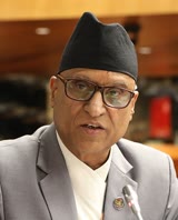 Dilendra Prasad Badu
 Shankar Singh Bisht
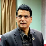 Ganesh Singh Thagunna
 Mount EverestEarth's highest mountain
 HimalayasMountain range in Asia
 KathmanduCapital and largest city in Nepal
 Kangchenjunga3rd-highest mountain on Earth
 Annapurna (mountain range)Mountain range in the Himalayas
 Dhaulagiri7th-highest mountain on Earth
 Makalu5th-highest mountain on Earth
 Lhotse4th-highest mountain on Earth
Questions
- Where is Darchula District located?
- Darchula District is located in Sudurpashchim Province, Nepal.
- What is the population of Darchula District?
- The population of Darchula District is 133,310 (as of 2011).
Sources
- Wikipedia (English): Darchula District · CC BY-SA 4.0
- Wikipedia (Nepali): दार्चुला जिल्ला · CC BY-SA 4.0
- Wikidata item Q28601 · CC0 1.0
- Image: Darchula.jpg by Dr. Unknown (CC BY-SA 4.0)

Last updated · facts checked 7 November 2026
Cite this page
"Darchula District". DigiNepal. Last updated 31 October 2026. https://diginpl.com/places/darchula-district. Retrieved 7 November 2026.